Overlanding The White Rim Trail
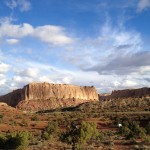
The White Rim Trail: Canyonlands Utah
Some experiences in life often end up over hyped and leaving me with that feeling of wishing and wanting for more. So heading into our trip on the White Rim Trail I was feeling a little apprehension worried that my high expectations wouldn’t be met. After 4 days and 3 nights I only have one regret…. that we had planned for a full week instead. I can say it was one of the best experiences of my life. Not only were my through the roof expectations met but they were far exceeded!
The White Rim Trail is an iconic Overlanding trip which ends up on everyone’s bucket list as soon as they learn about the trail. Over 100 miles off road trails, thousands of stunning views and breathtaking landscape that seems to have endless vastness, it’s on every adventurers bucket list. Despite growing up in Utah and having been on many trails across the state I’d never tackled it and it was about time!
Mike and I have been talking about the trail for months, looking at dates that would allow us to meet in Monticello jump in the Jeep and give this trip the time it deserves. I know the trail can be driven faster than we did it, but we wanted to do it right. Take time to stop, take in the views, explore, hike and even backup and go over an amazing section of trail again when we wanted. After reading countless trip reports on Expedition Portal and ADVRider we booked permits for late February and started planning. We put together a 20 minute version of the trip on our YouTube channel.
We also have a much more detailed trip report below.
Day One Friday
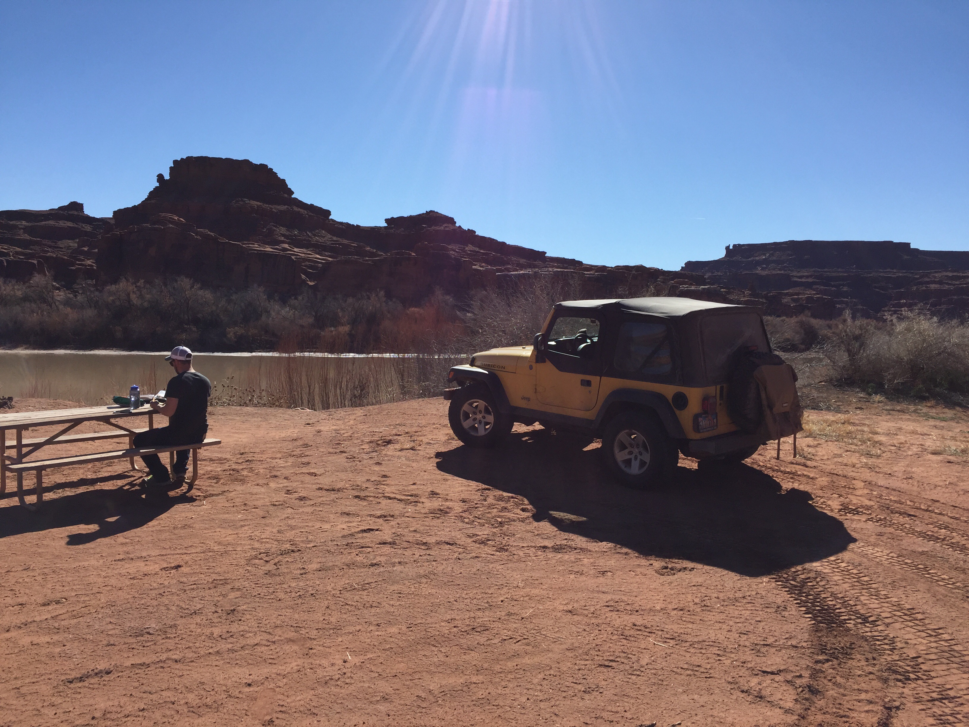
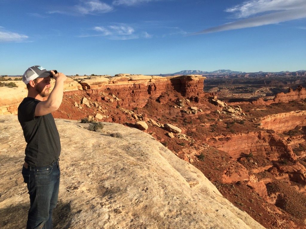
Mike was coming up from Roswell New Mexico and I was headed south from Highland, Utah so we decided to meetup on Thursday night in Monticello Utah, just south of Canyonlands National Park. I have family in the area which I wanted to see and we wanted a good place to leave Mikes truck so this made the most sense. Passing through Moab on my way through was almost to much to handle and my excitement level had me giddy. We both rolled into Monticello fairly late and spent some time moving gear around and then chatting with our hosts. The plan was to sleep in so that we were well rested, grab lunch in Moab and hit the trail. So naturally I was awake at 5am looking over our trip notes and waiting as long as I could before waking Mike up. We set out early and ended up grabbing a quick breakfast in Moab and then headed to the trail.
When doing our trip planning we knew the Shafer Switchbacks might be closed due to the weather but we were told to check-in just in case before setting out. We were calling the National Parks office the second the clock turned 8:00am, something I bet these workers are used too. Moments later with a small amount of disappointment we were headed in via Potash road as the switchbacks were still closed due to the recent snow and resulting mud.
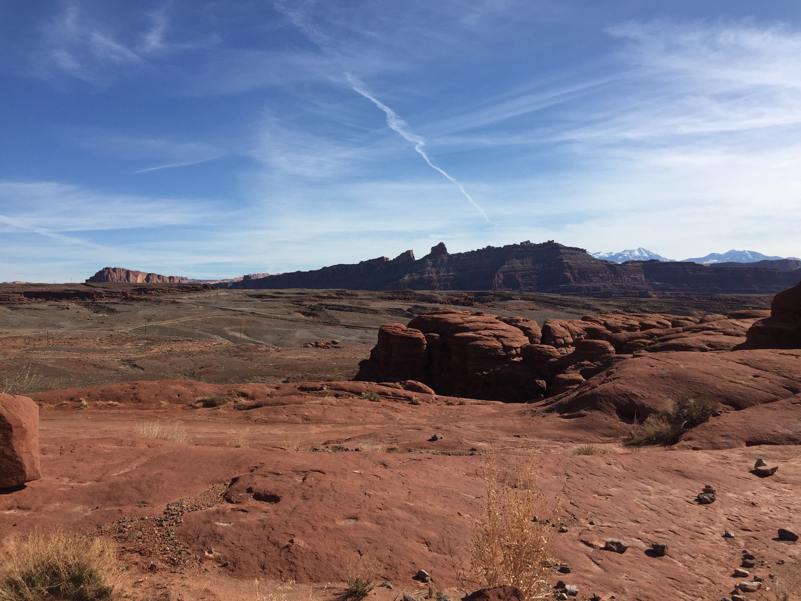
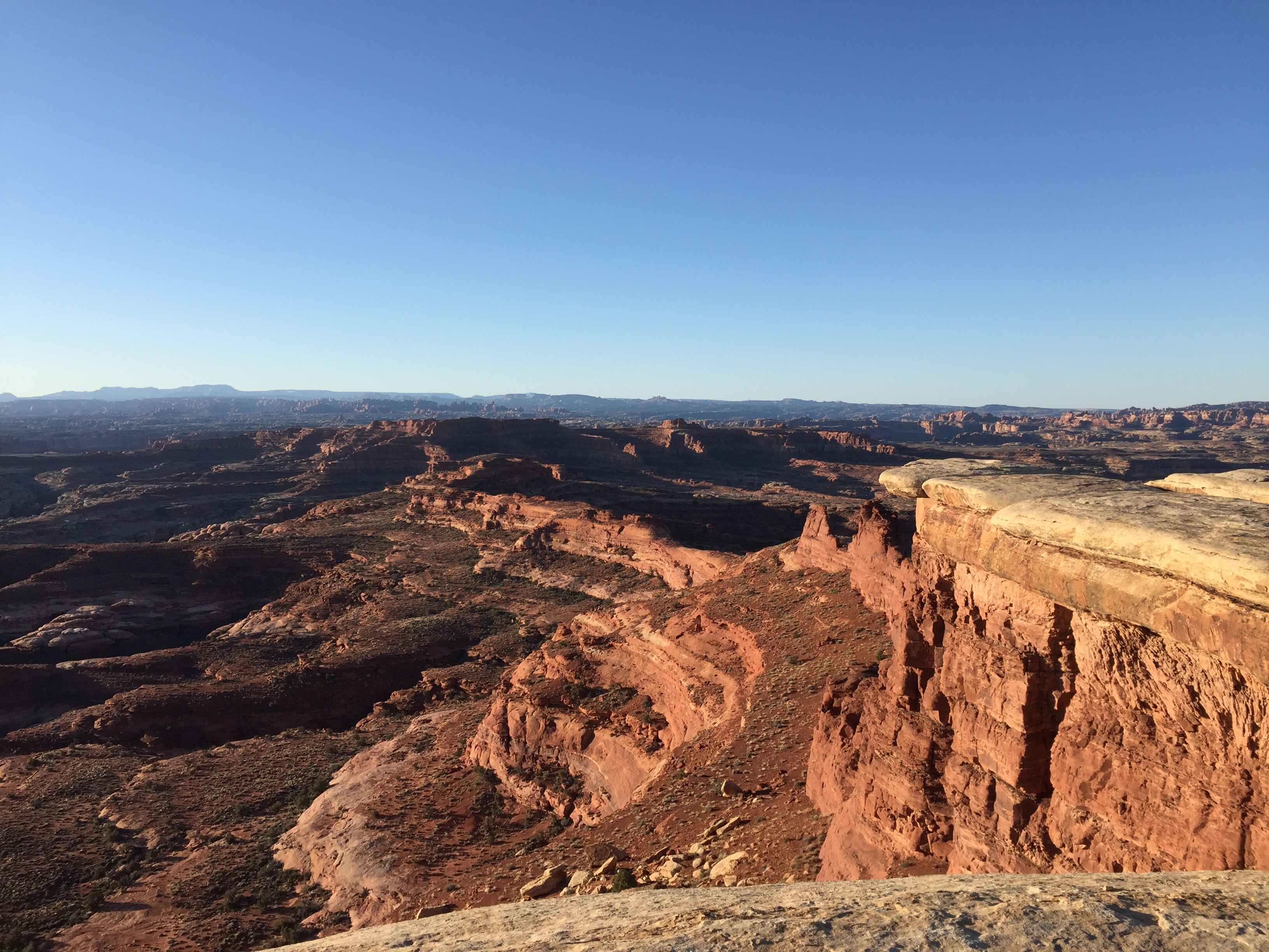
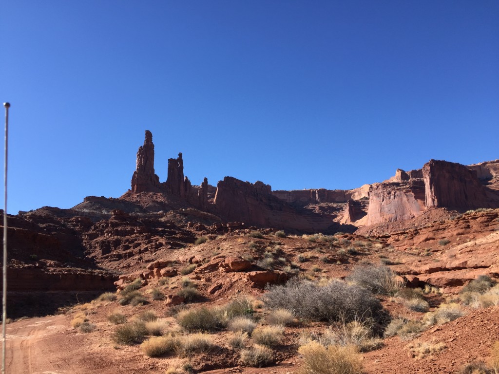
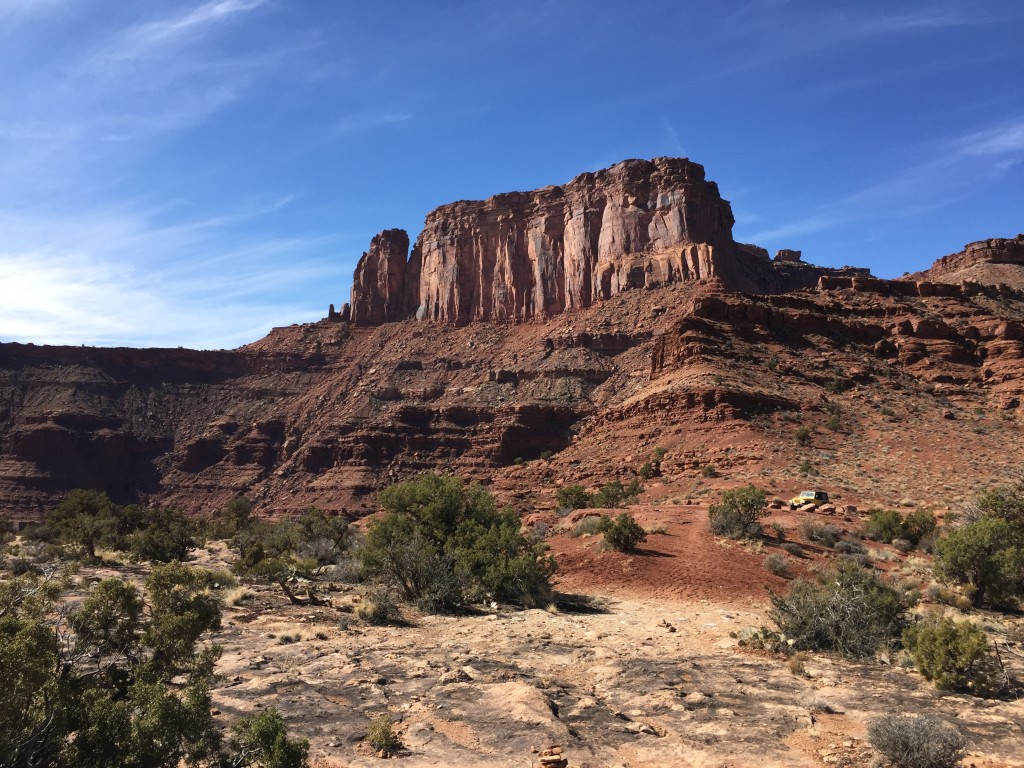
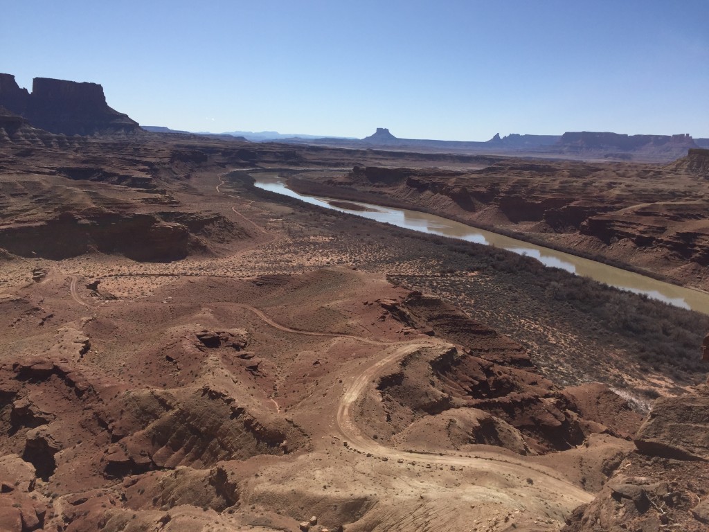
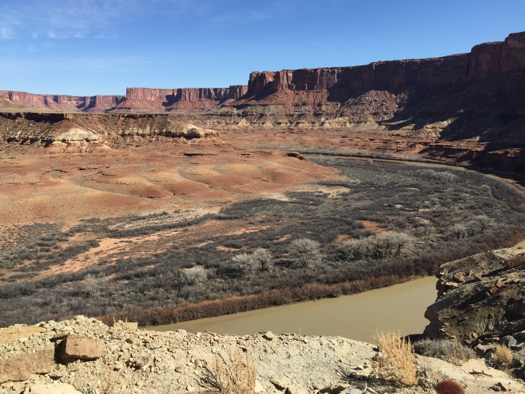
Our disappointment immediately washed away as we left the pavement and started our journey along Potash road. No doubt this road alone is well a day trip while wheeling or exploring Moab. The red rock is so unique and beautiful that your mind has a hard time processing everything. It took us close to 3 hours to make the 30 miles from Potash to the White Rim Trail because we were stopping every mile or two to take pictures, record video and do some exploring.
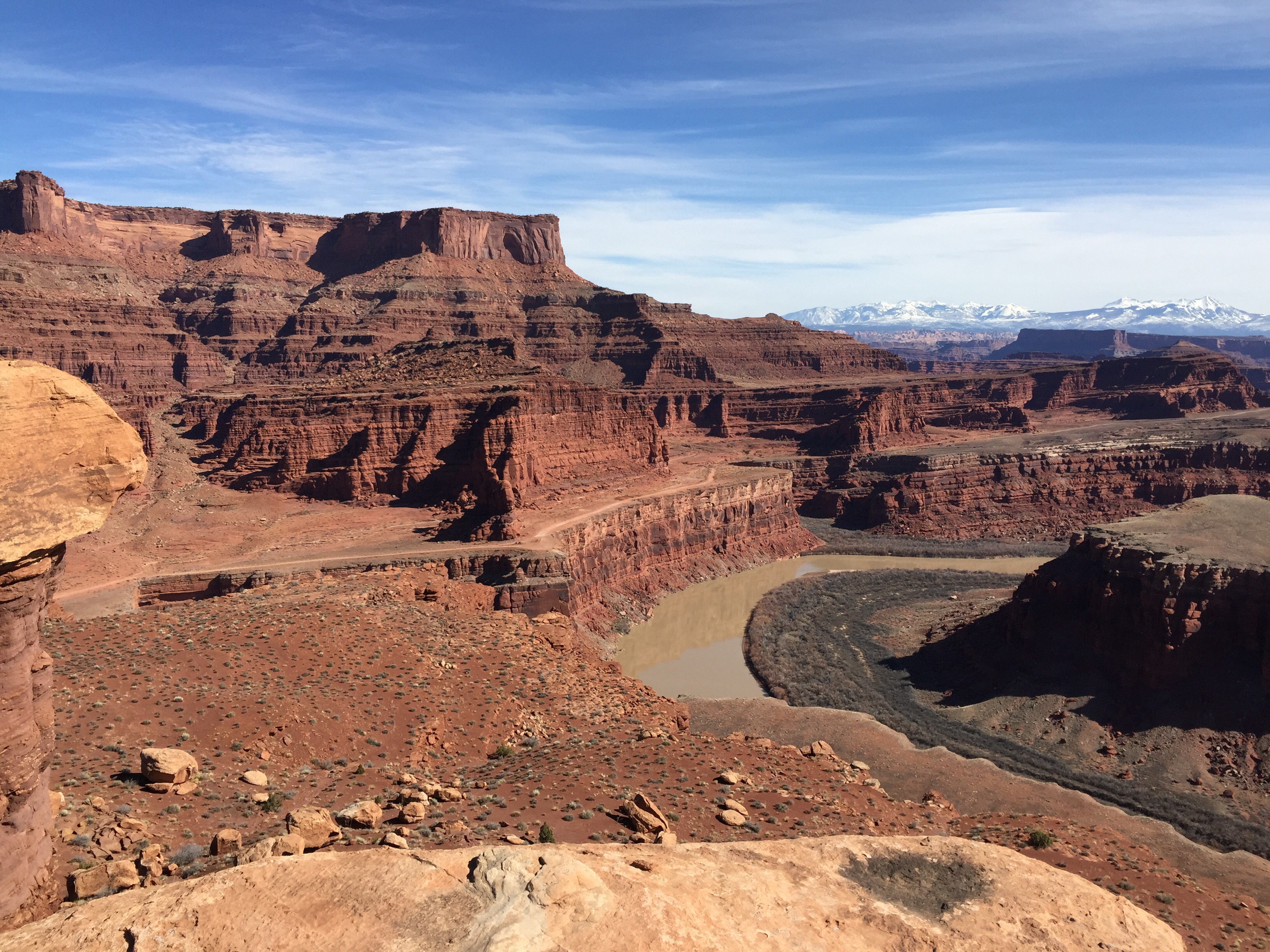
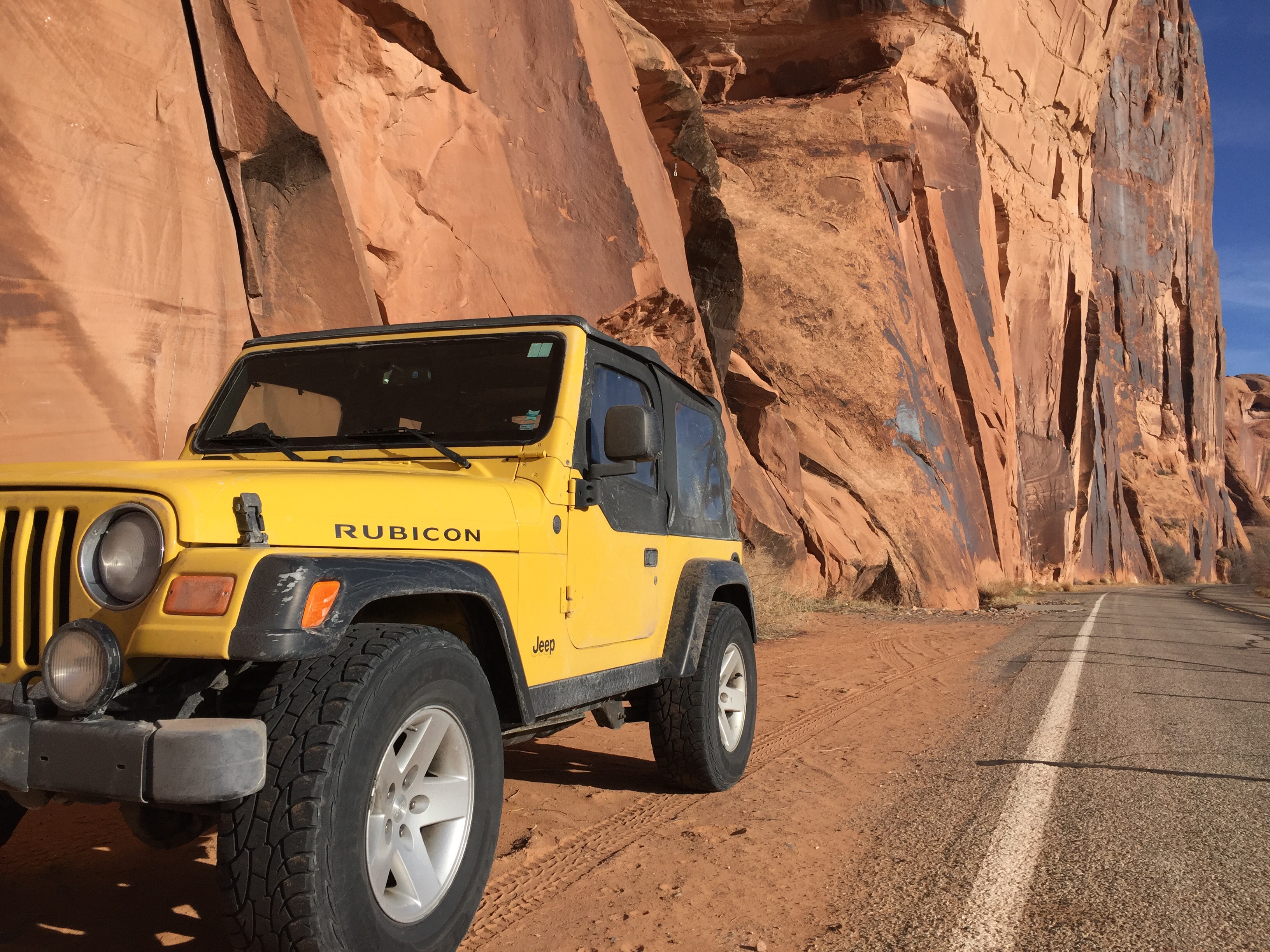
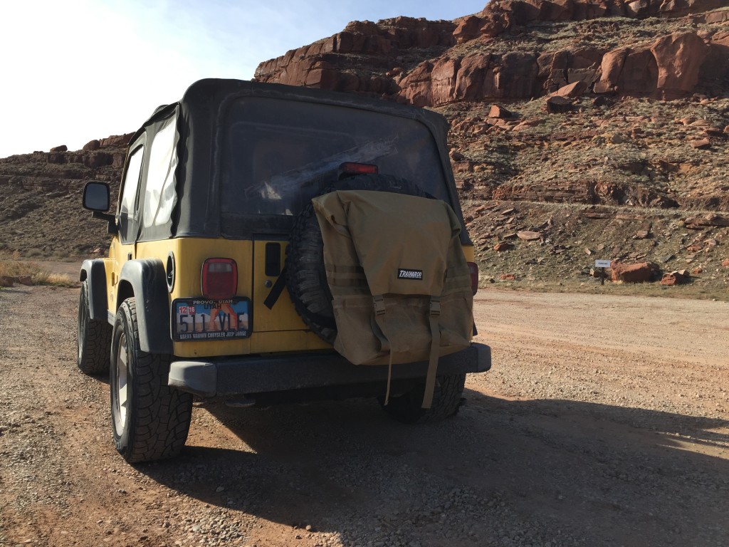
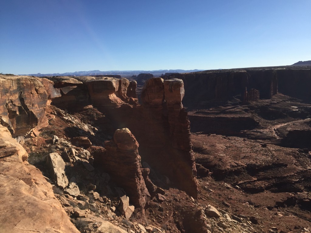
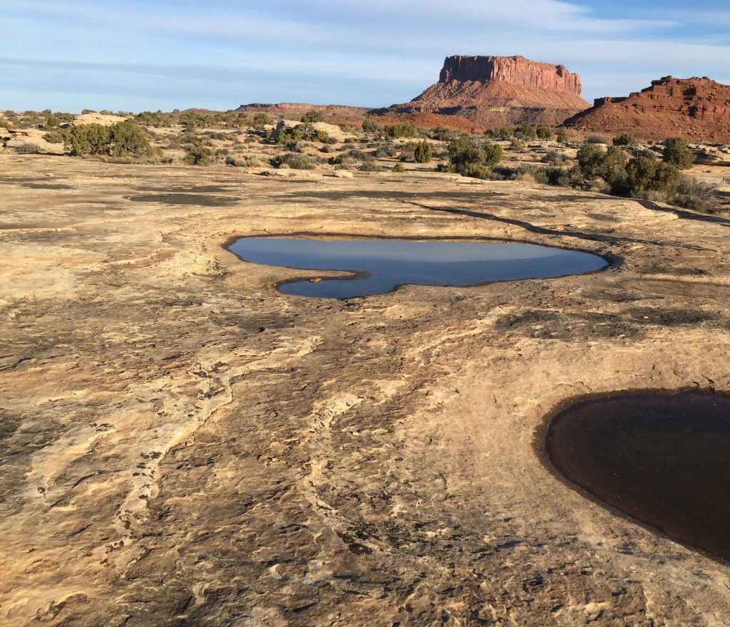
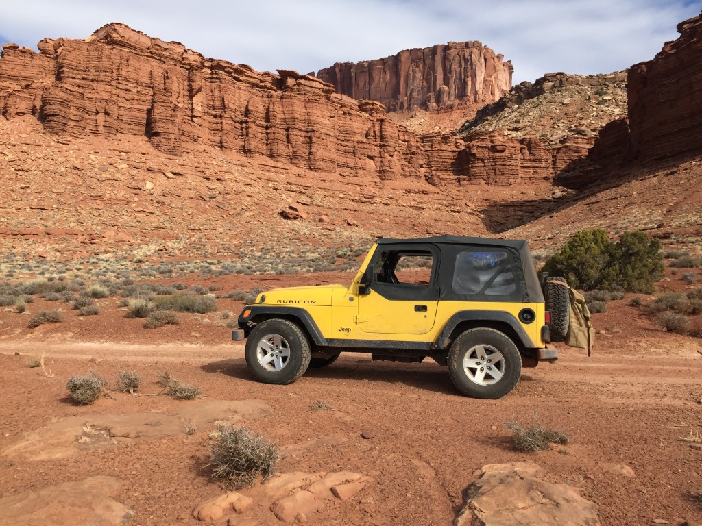
Ten miles in we decided to air down our tires to 25 PSI to improve our ride comfort and increase our traction just in case. The 2004 Jeep Rubicon is already very comfortable off-road and airing down further enhanced the ride. We made the usual stops at the Colorado River Overlook, and Mussleman Arch both worthwhile stops that can turn into a few hours of hiking around checking things out with ease. Next we set out to checkout Lathrhop Canyon.
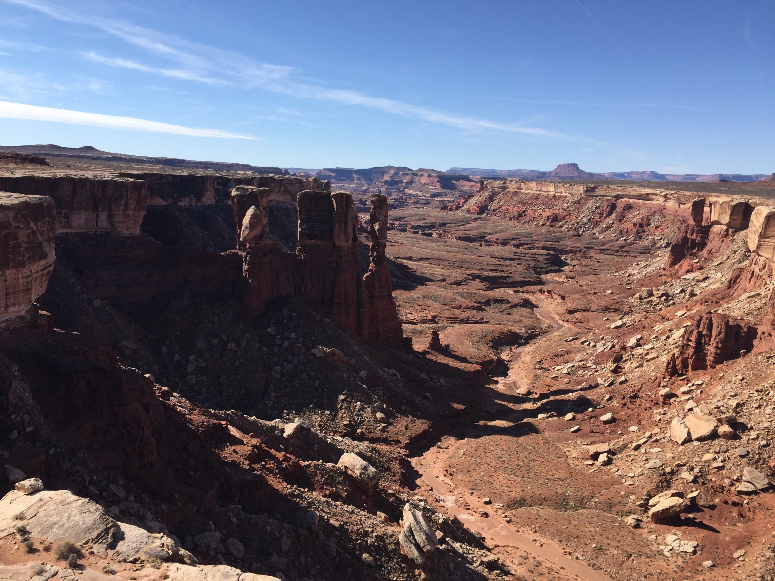
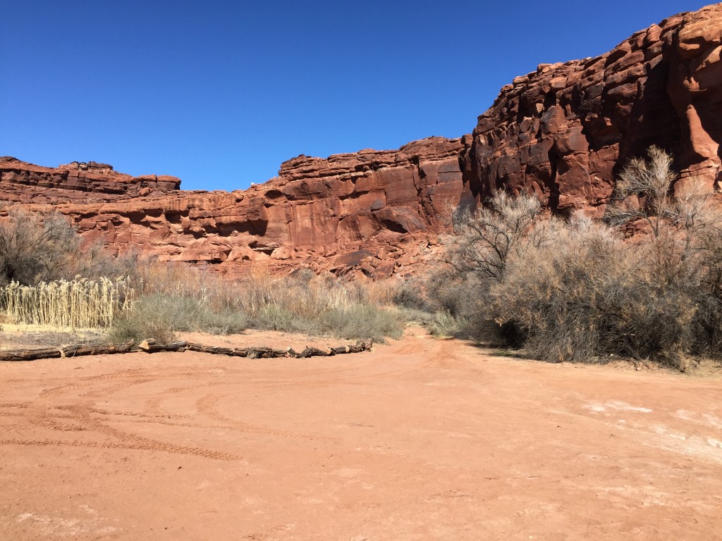
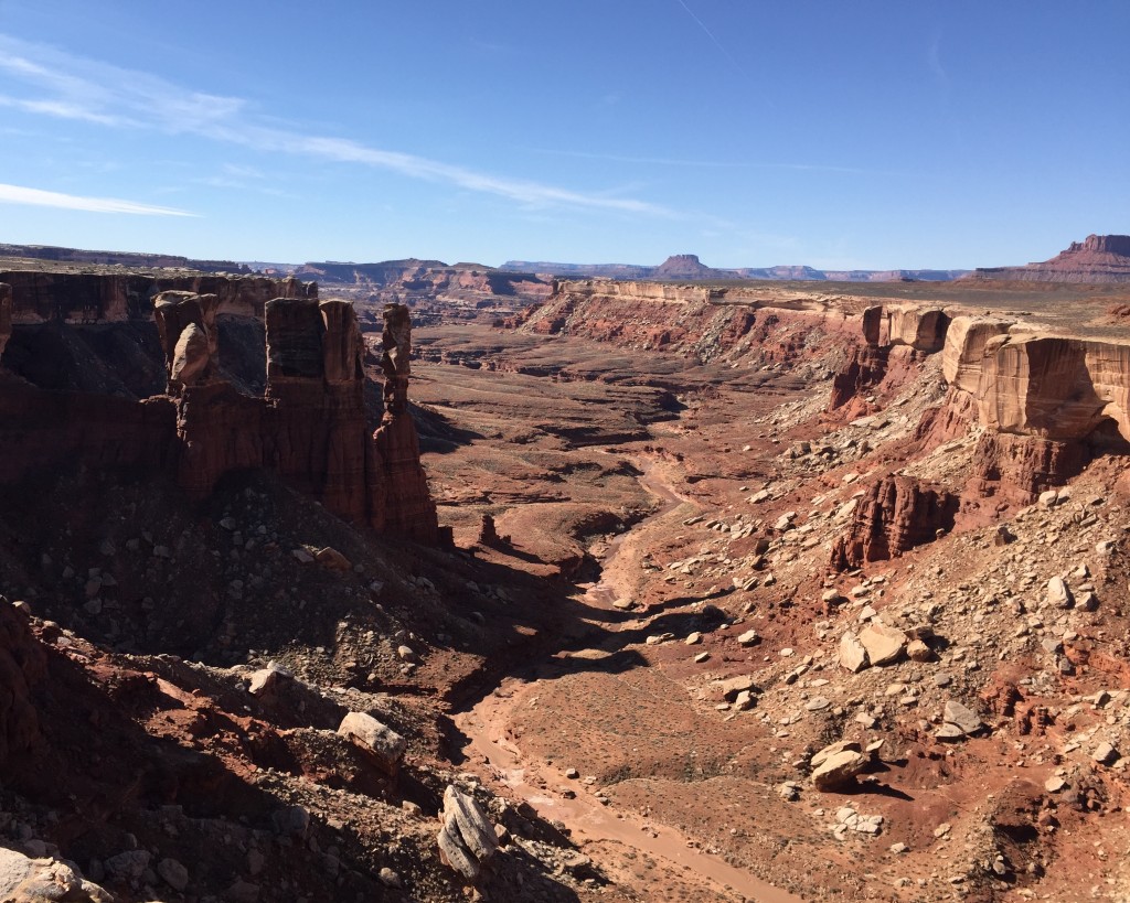
Lathrop Canyon
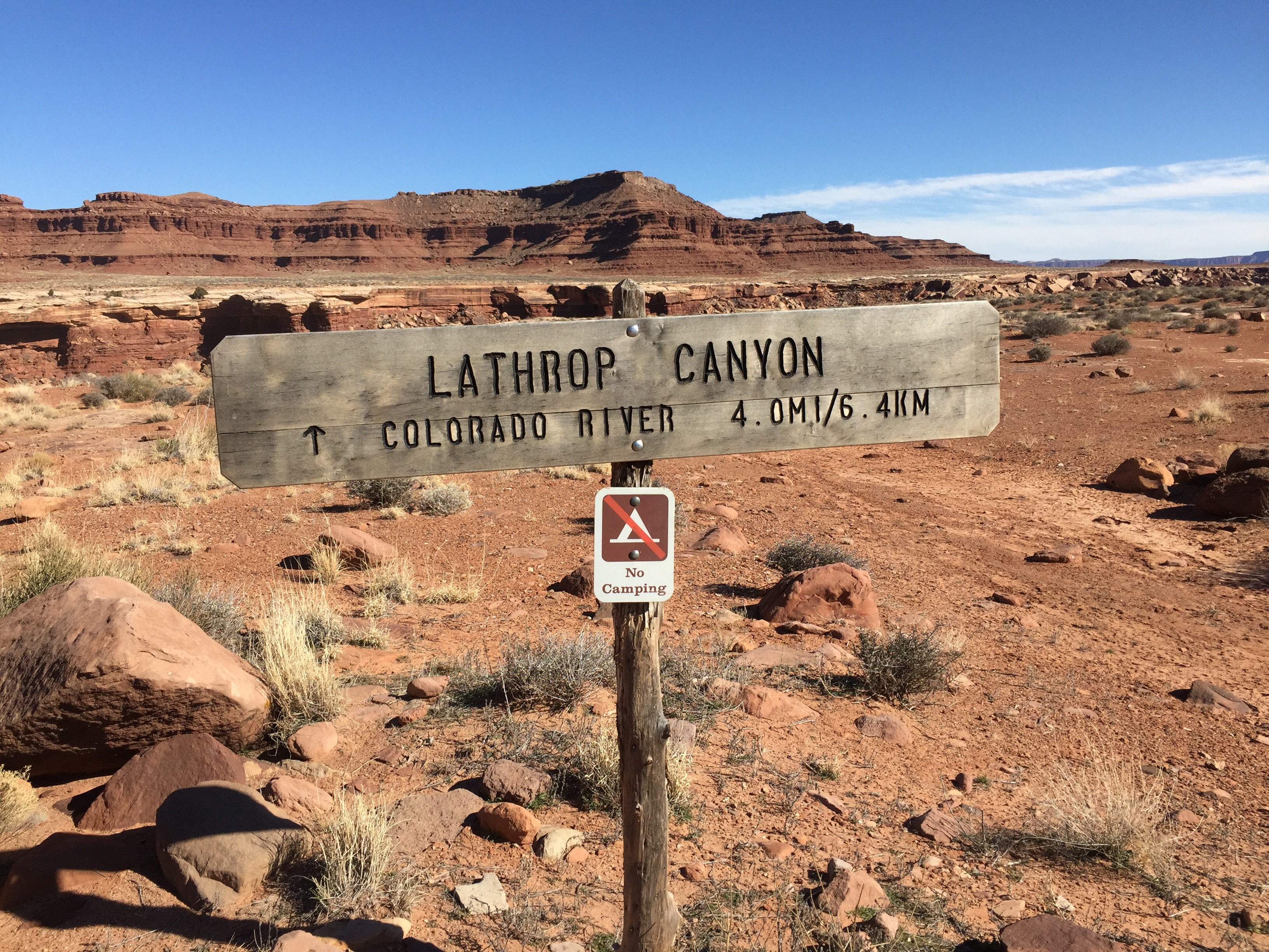
Is a must see part of the White Rim Trail in my opinion. The steep descent funnels you into a beautiful wash where you weave your way down to the Colorado River. The trail ends in a beautiful opening with an incredible view and a few picnic tables and a pit toilet. We stopped here for lunch and tried compare how the past 4 miles stacked up to many of the other short trails we have driven. The Canyon was my favorite part of the drive Friday and can’t be overlooked. The trail is fairly aggressive and caution should be taken during inclement weather, longer full-size trucks without a lift might have clearance issues on parts of the trail, and turning can get tight on a few of the switchbacks. Just walk the sections you feel uncomfortable with and use a spotter when needed and you should be able to make it down. Shorter wheel base SUVs and overland rigs will find the trail moderate at it’s worst, we never even put the Rubicon in 4-Wheel Drive.
Day One Continued
Once we made it back out of Lathrop Canyon we set a solid pace and headed towards the highly coveted White Crack Campground. Of course we made several stops along the way, often crawling on our stomachs to look over the cliff edge and toss a small rock off to see how far down it was. We had spent so much time exploring it was already late afternoon and we wanted to setup camp in the light as well as have some time to explore
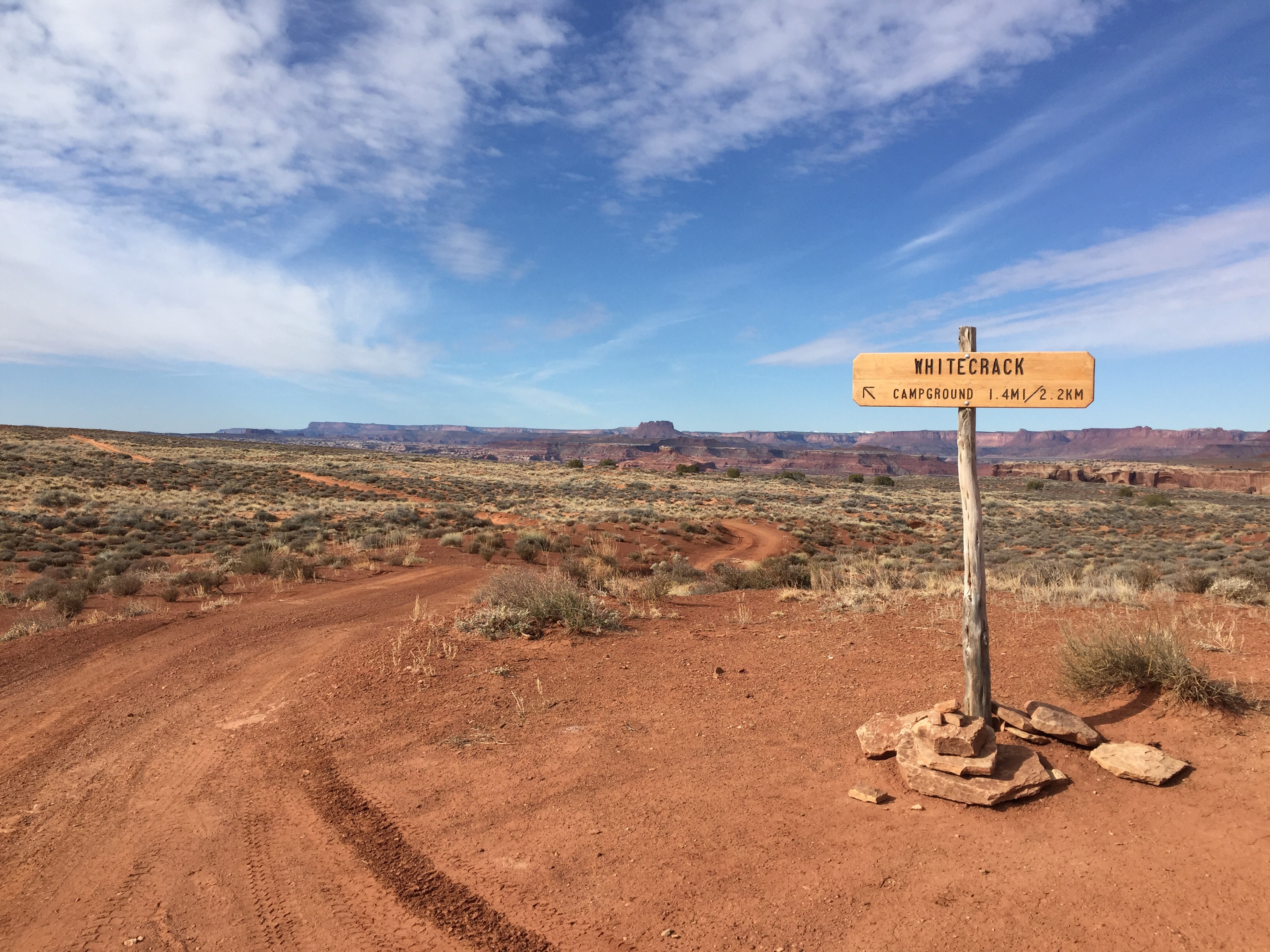
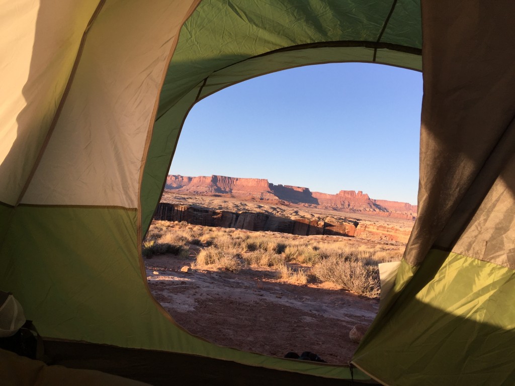
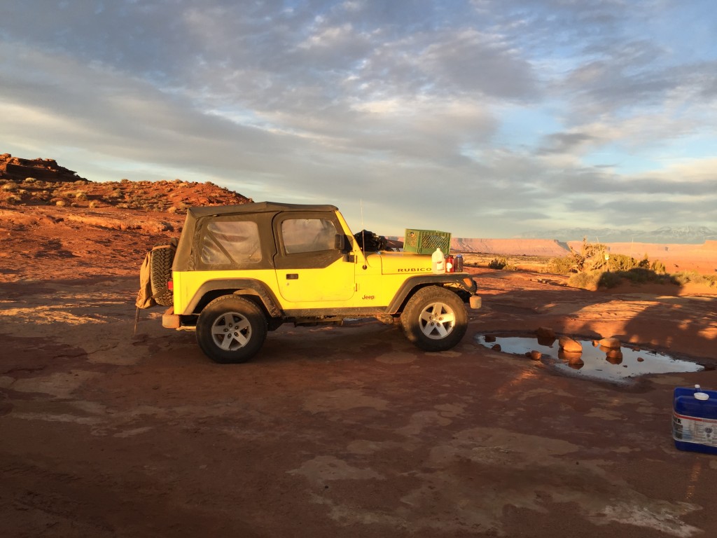
“Whitecrack”. We pulled in around 5 and quickly pitched our tent, and slammed down a quick dinner. We spent the rest of night looking over Whitecrack, marveling at the beauty and discussing our plans for day two. We we worn out from hiking, so once we had transferred all of our video footage to our laptop we hit the sack. The weather was near perfect the entire trip, the first night was our coldest but still never dropped below thirty which was great for late February.
Day Two Saturday
We woke up early and set out to watch the sunrise, which was breathtaking.
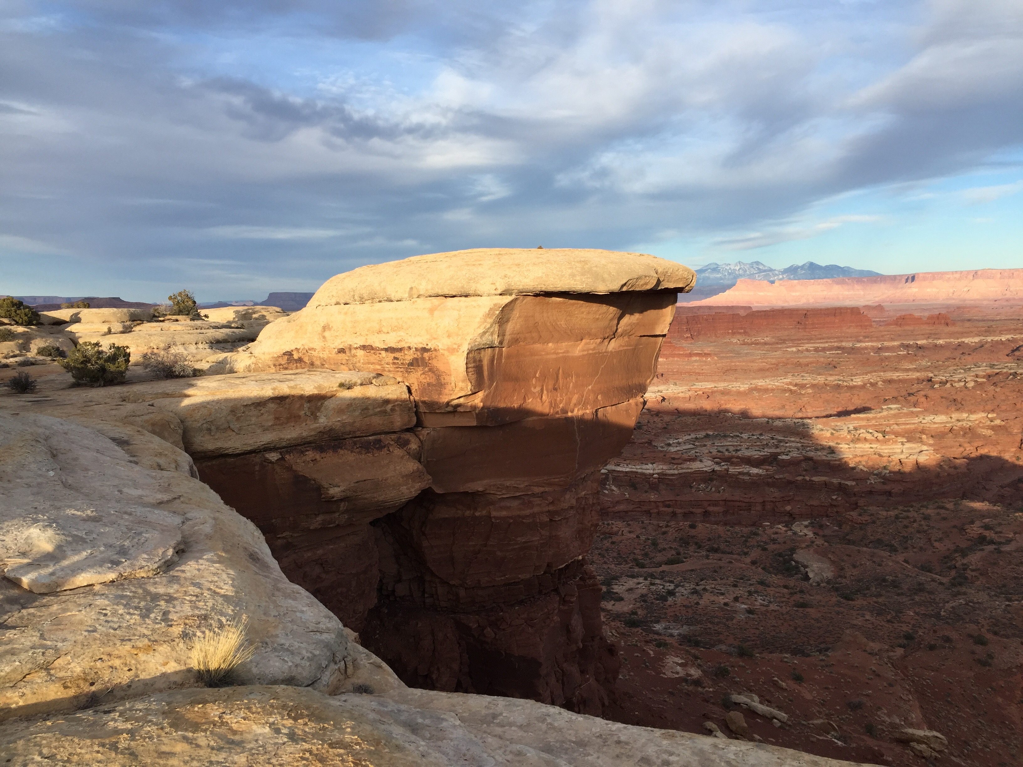
We noticed a small outcropping of rock that looked to have a great view but took a little bit of scrambling up to reach the top. With certain death on each side of falling we discussed weather or not we thought anyone else had been up on this ledge. I determined someone else certainly had to have made the short climb in the past. As we approached the edge we sat down and just soaked in the beauty in silence for quite some time. Once we stood back up I noticed a small red rock near our feet. Sure enough it was an arrow head, we spent a few more minutes looking around and found a crack in the rock with several more and what looked to be some rocks that didn’t make the cut.

The region has a rich Native American history and I couldn’t help but think about what it must have been like then. No doubt whomever was working on arrowheads on that ledge was as awestruck by the view as we were.
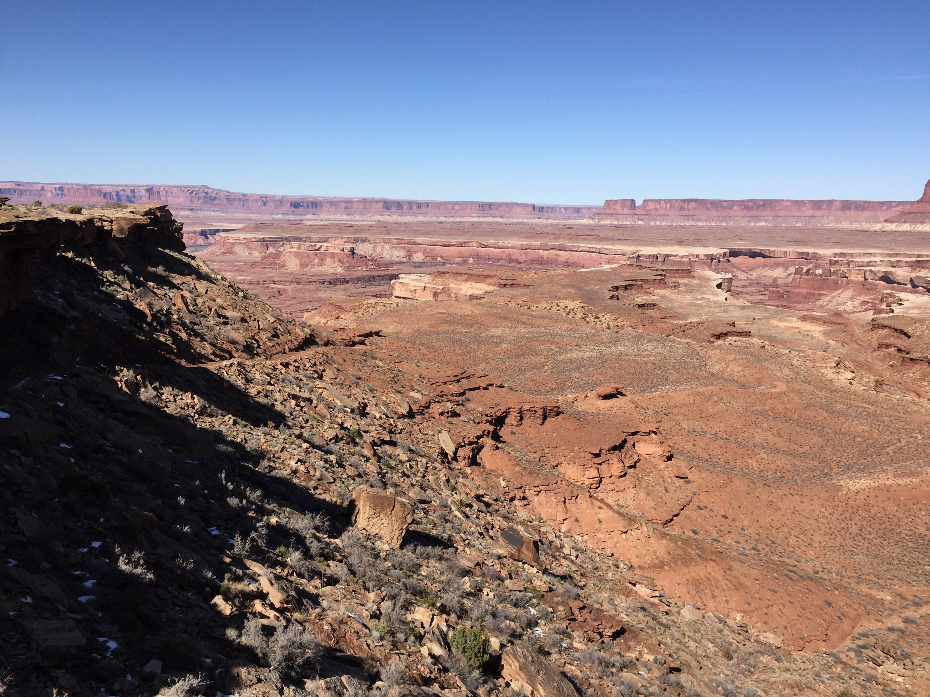
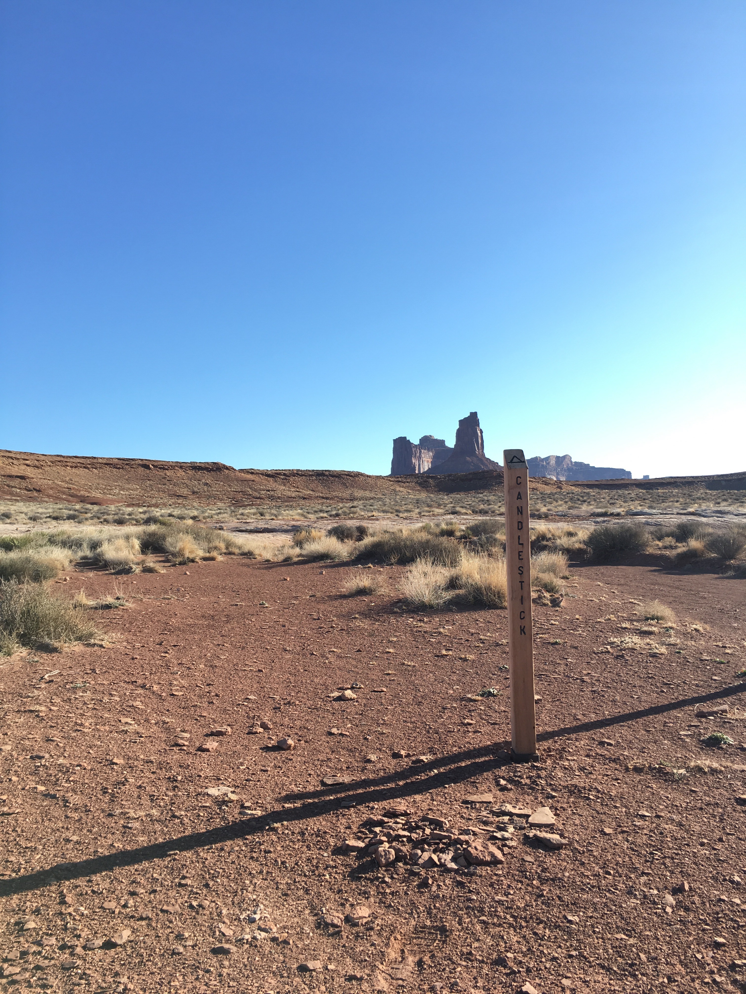
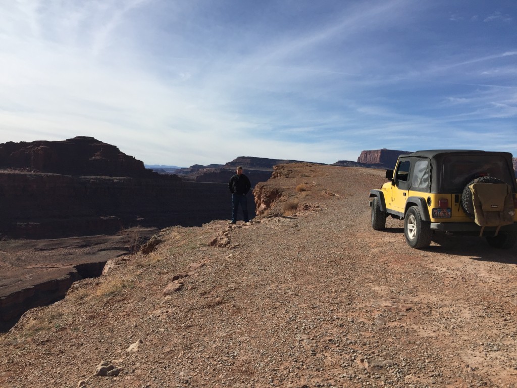
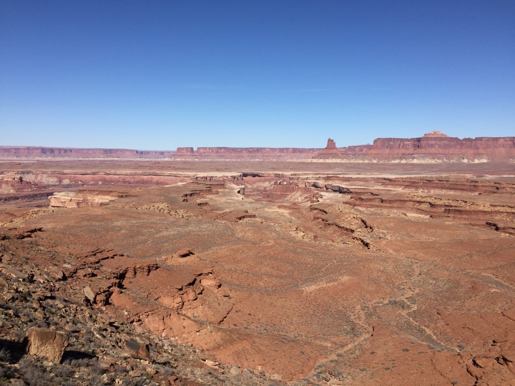
Once we had eaten nice warm breakfast we quickly broke camp and arranged the Jeep for another 30 miles on the trail. We were headed to Candlestick and knew the days drive would feature the climb up and down the Murphy Hodgback Plateau which would include the most technical part of our drive which was exciting. Once on the trail things felt…. right. I had the sweeping feeling that this is what I want to do with every spare moment in life.
We stopped several more times along the trail to take in the view, but in general we were making better time than the day before.

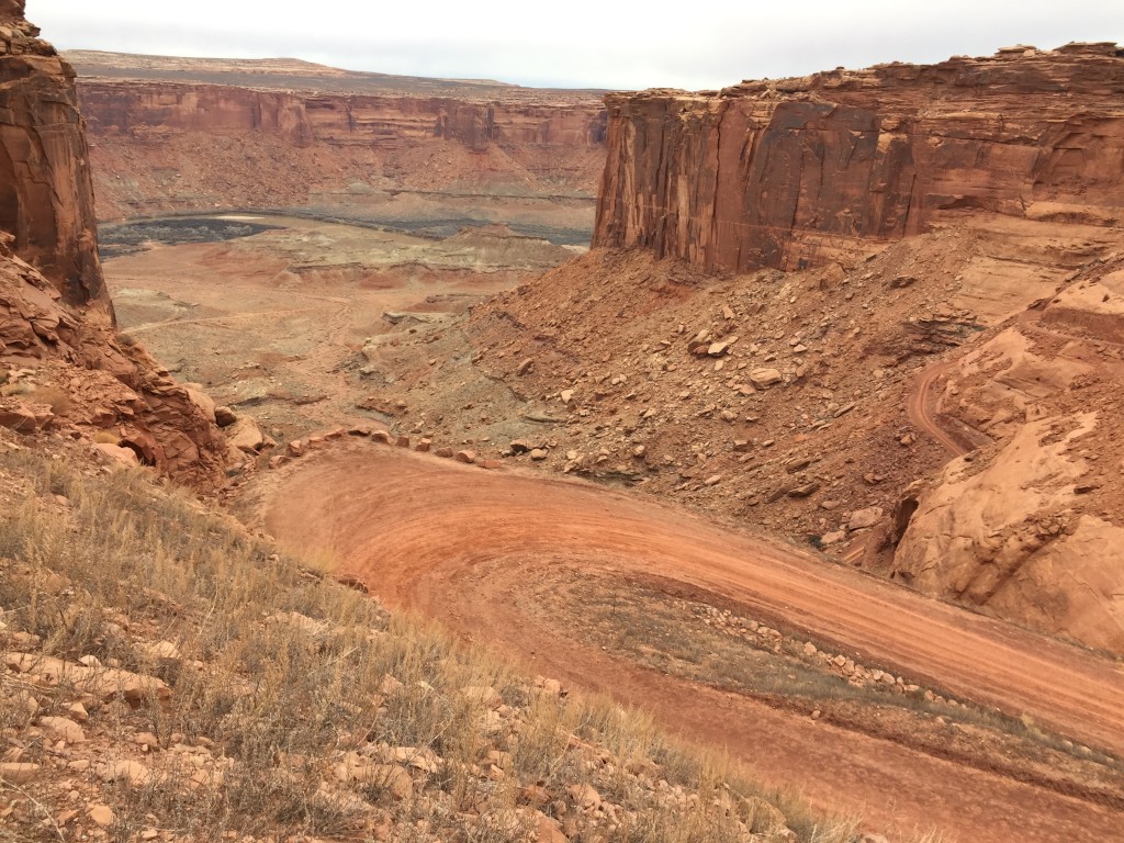
 The trail had a few technical sections where we were glad to have 4 low, with slick muddy clay and seriously steep switchbacks climbing up Murphy Hodgback Plateau. Other than a couple we saw the first day close to where Potash and The White Rim Trail meet we had not seen another rig. As we were climbing I was VERY glad we didn’t run into someone coming down, as making the pass would have been tedious at best, and disastrous at worst. Once up we saw the descent trail which made us nervous, mostly there was a pretty good ledge drop with mud as our base and a steep drop off on the right hand side of the trail.
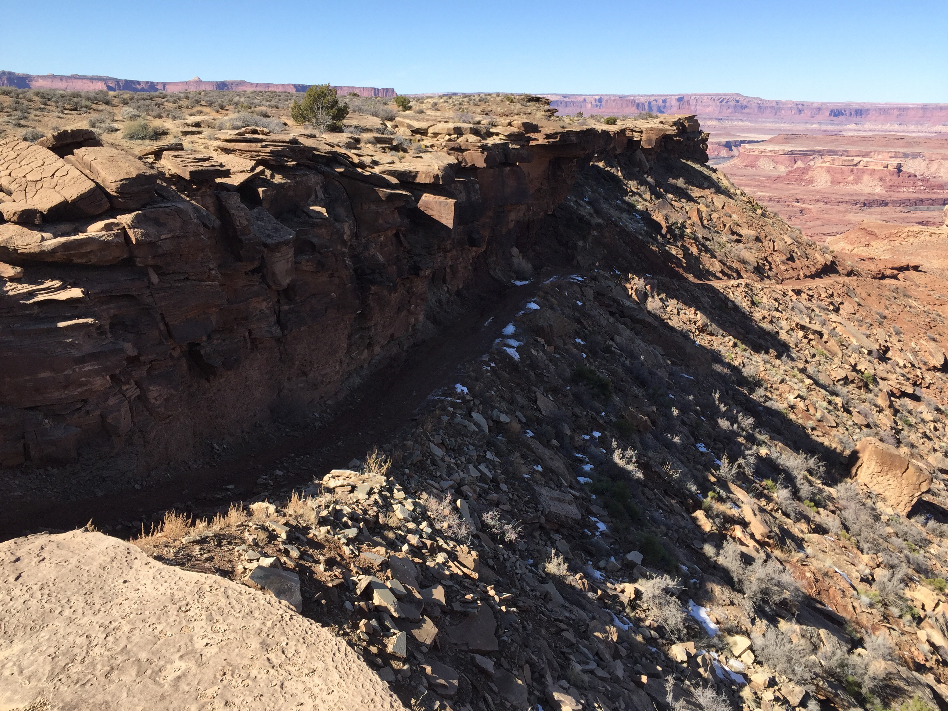 Mike jumped out as my spotter and I again put 4 low to work and everything went as smooth as we could have hoped for. The ledge drop felt minimal and we experienced next to no sliding. My guess is someone had attempted the trail in muddy conditions running counter clockwise and dug in a bit right here making it worse than normal.
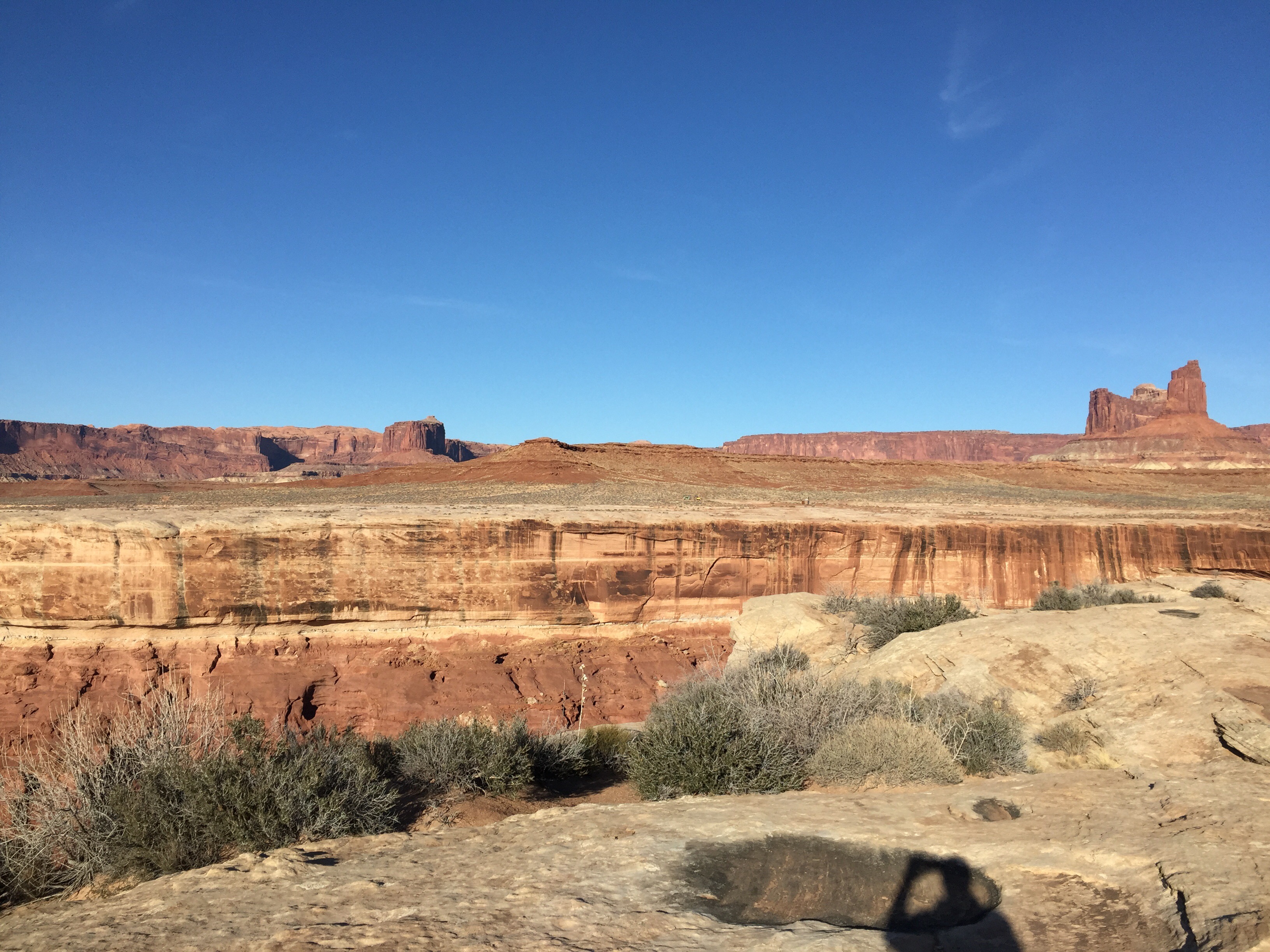
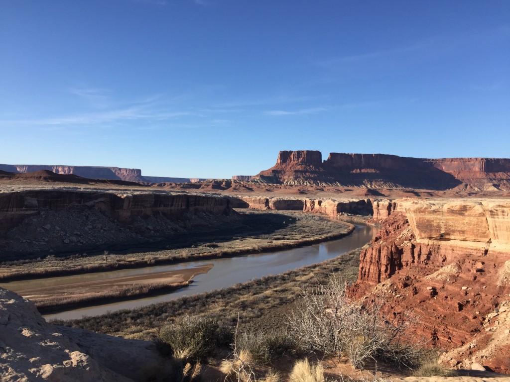
Once we descended the rest of the drive to Candlestick was beautiful smooth. Several sections of the trail are flat and very smooth making the ride fast and very fun. In total we covered just around 35 miles, around 2 we pulled into the Candlestick campground where we quickly setup camp and starting preparing lunch.
The Candlestick campground is picturesque with a lot of places to explore close by. We spent the next 4 hours hiking the rim looking out over the Colorado River. We were hoping we could find a place to scramble down but after a few hours without finding something we felt really confident in we headed back to camp to cook dinner.

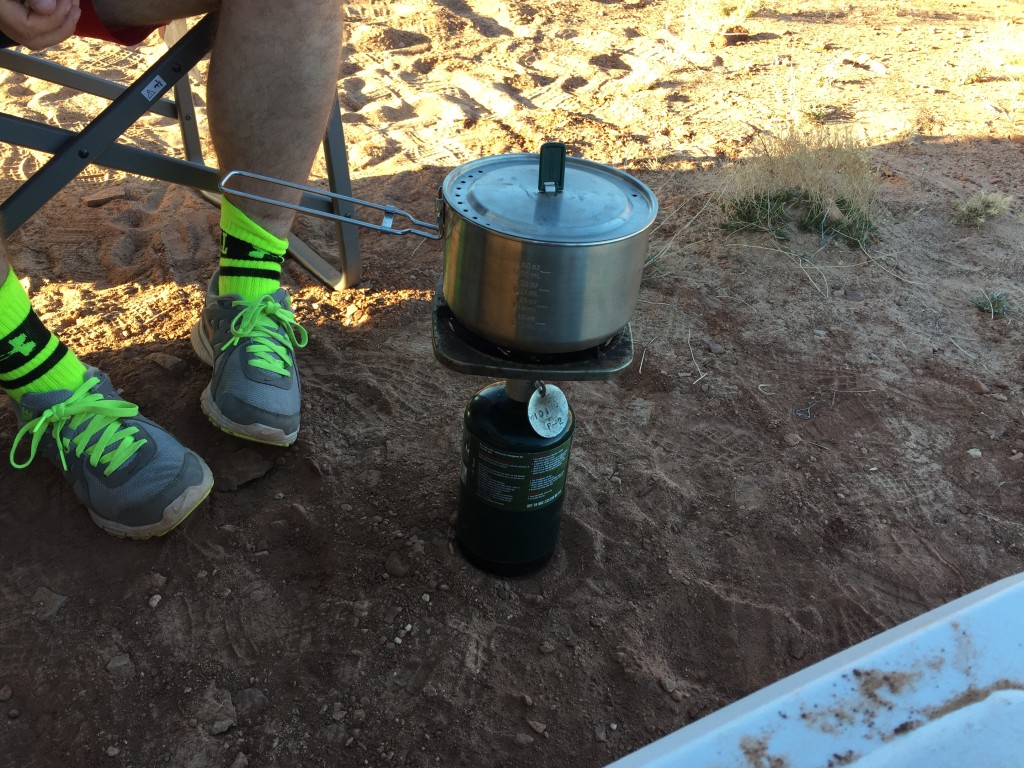
For meals we kept things simple using a small single burner propane burner, enough to easily cook for two people. After finishing up we started to hear some vehicles approaching two dual sport bikes zoomed by slowly followed by a chase vehicle.
Not 10 minutes after they passed we saw enough another rig moving our way. A nice couple from Farmington, New Mexico rolled up in a Blue FJ. We spent a few minutes talking about the Murphy Hodgeback climb we all agreed we were glad we were going down the ledge rather than up. It was getting late and they were hoping to make it to the next campground before it was completely dark.
Day Three Sunday
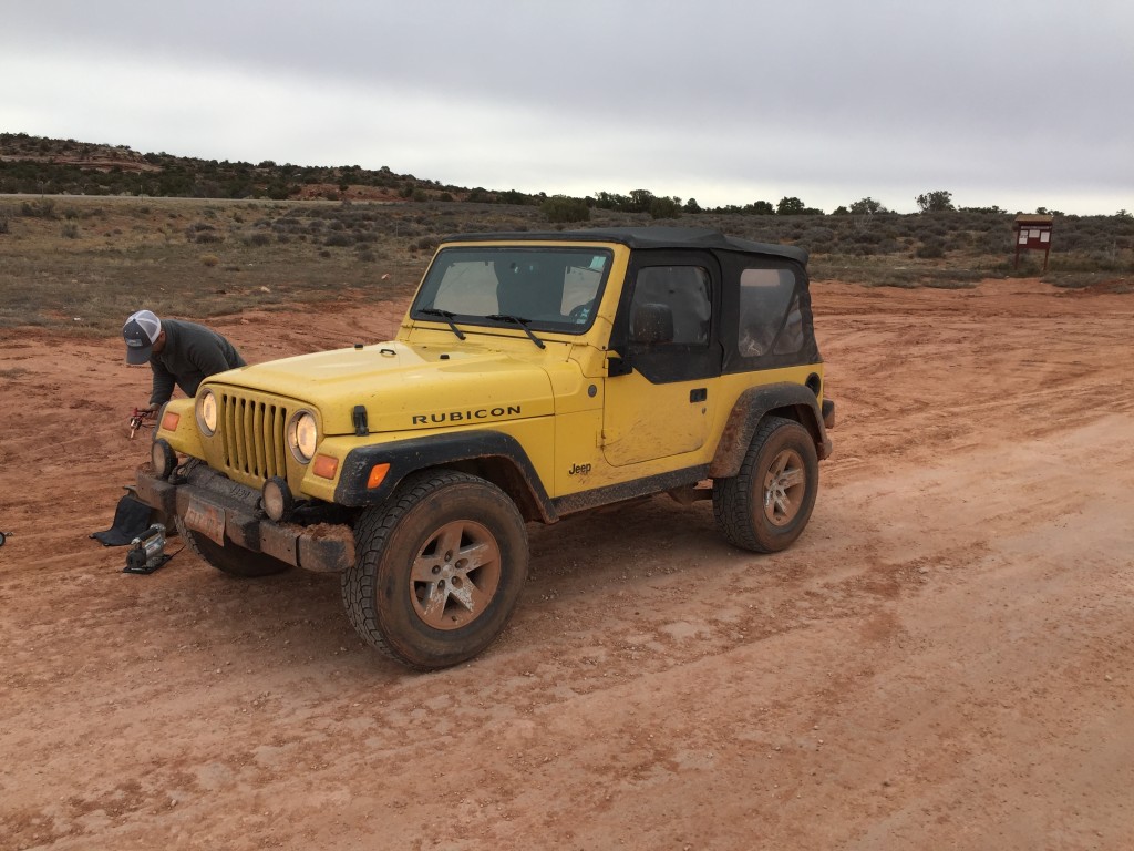
Feeling refreshed after a better nights sleep we were excited to hit the trail again. Our goal for the day was to like Fort Bottom trail and drive Taylor Canyon before stopping for night at Labyrinth. After breakfast we starting loading things up, when we went to start the jeep it would not turnover over. With no one near by we knew we only had a few options. Knowing we would be fairly remote we brought a long a small portable power pack to help charge devices, and give us the chance to jump our rig in case we were in a bind. We also knew if we could find a slight hill we would be able to bump start it. Thankfully the jump starter pack worked perfectly and we were able to get the Jeep running. Once running we decided there must be an issue with the batter so we decided to run for a while, park on a hill and see if we could start back up. We knew we drive out that day if we needed but that would have changed our plans pretty significantly so we were happy to find that once we drove for a little while we had enough juice to start back up.
To be safe we left the Jeep running during our brief stops to take pictures and explore. Once we made it to Fort Bottom Trail we felt confident we could still stop and do the hike.
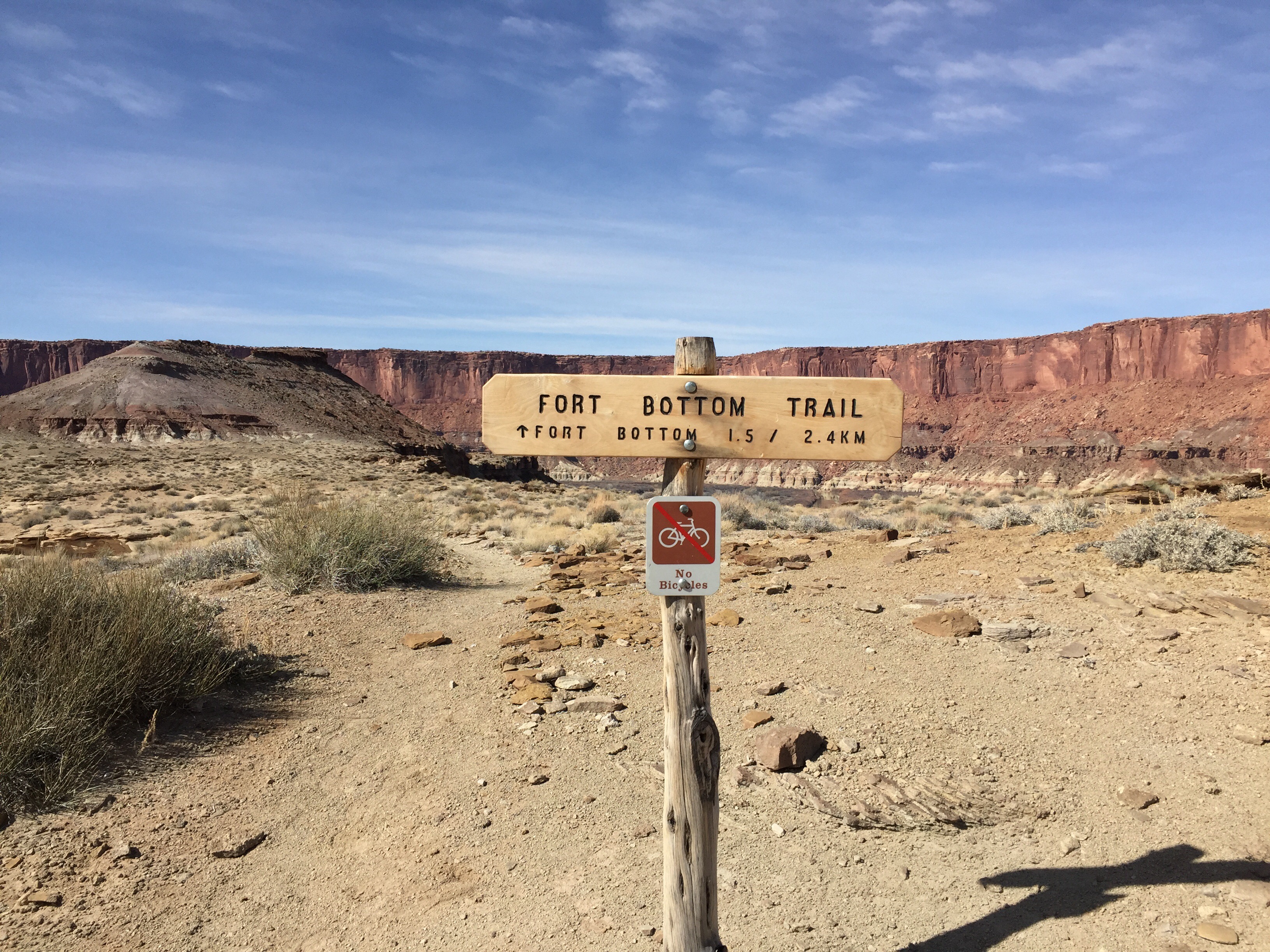
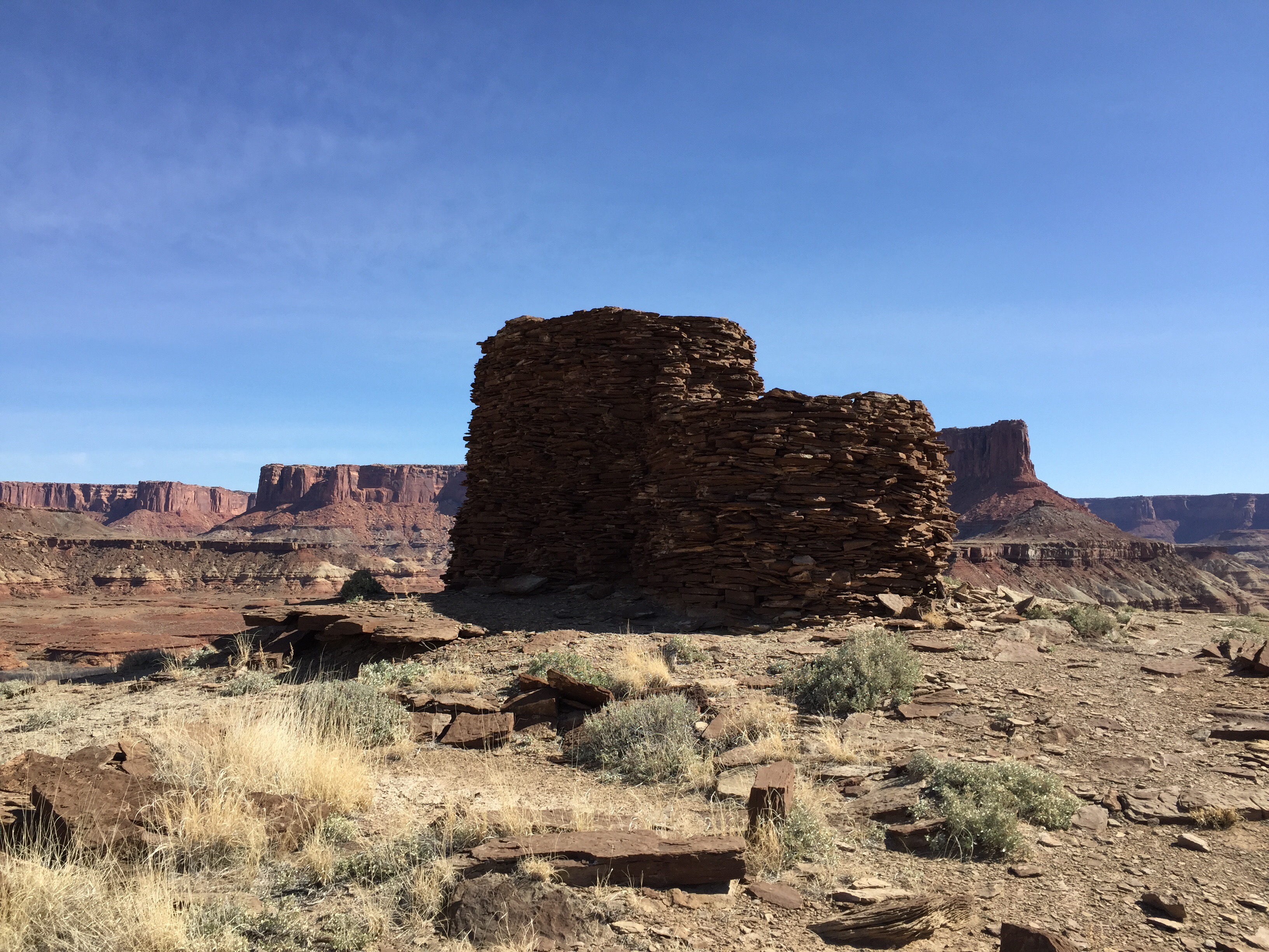
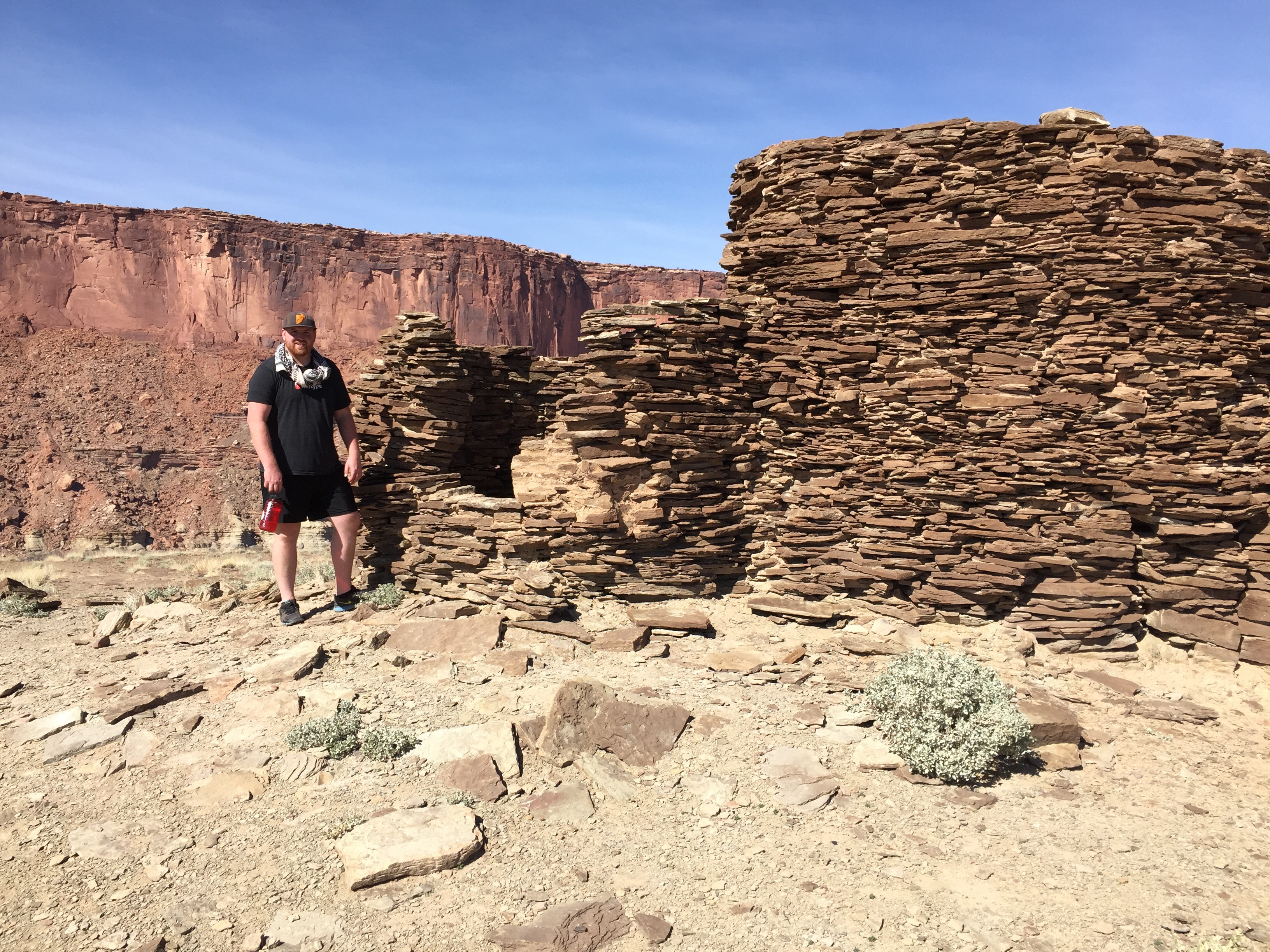
The 1.5 mile hike seemed a lot more like 2.5 miles, but it was totally worth it. The trail gets fairly narrow in a few spots with steep cliffs on each side. On multiple occasions you walk right along the ridge line, be careful if taking small children or someone who is not sure on their feet. Once we made it to where the Plateau where the Ruin is we were surprised to find that the trail just ended before making it up on top. We walked around looking for a way up and determined that where the trail seemed to have ended was the way up. I’m still not sure if the path had washed away some with the winter weather or if it really was that tough year round. We had to scale up about 10 feet where the ledge pushes your upper body back a little making you feel a bit nervous. I was glad I was there with Mike and not my two small kids. Once up we walked to the ruin and were in awe at how well the structure had held up. I was hoping there would be a plaque or something with a little more information the ruin. The vantage point was beautiful and was probably great for keeping an eye out over the valley and river below.
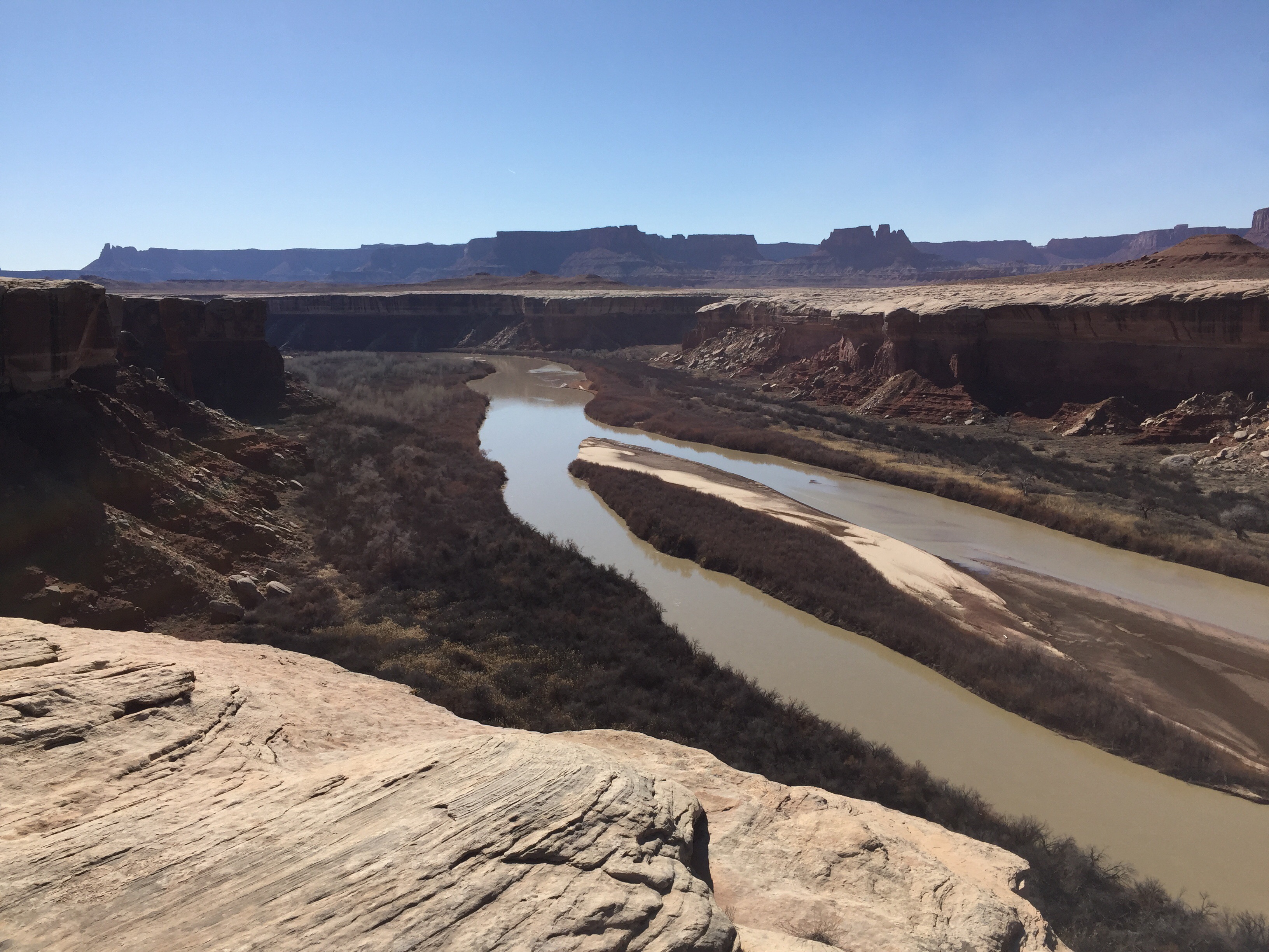
Once back to the Jeep we started to make our way down towards the Potato Bottom area. I really loved the Potato bottom campgrounds, close to the river with Trees and other vegetation.
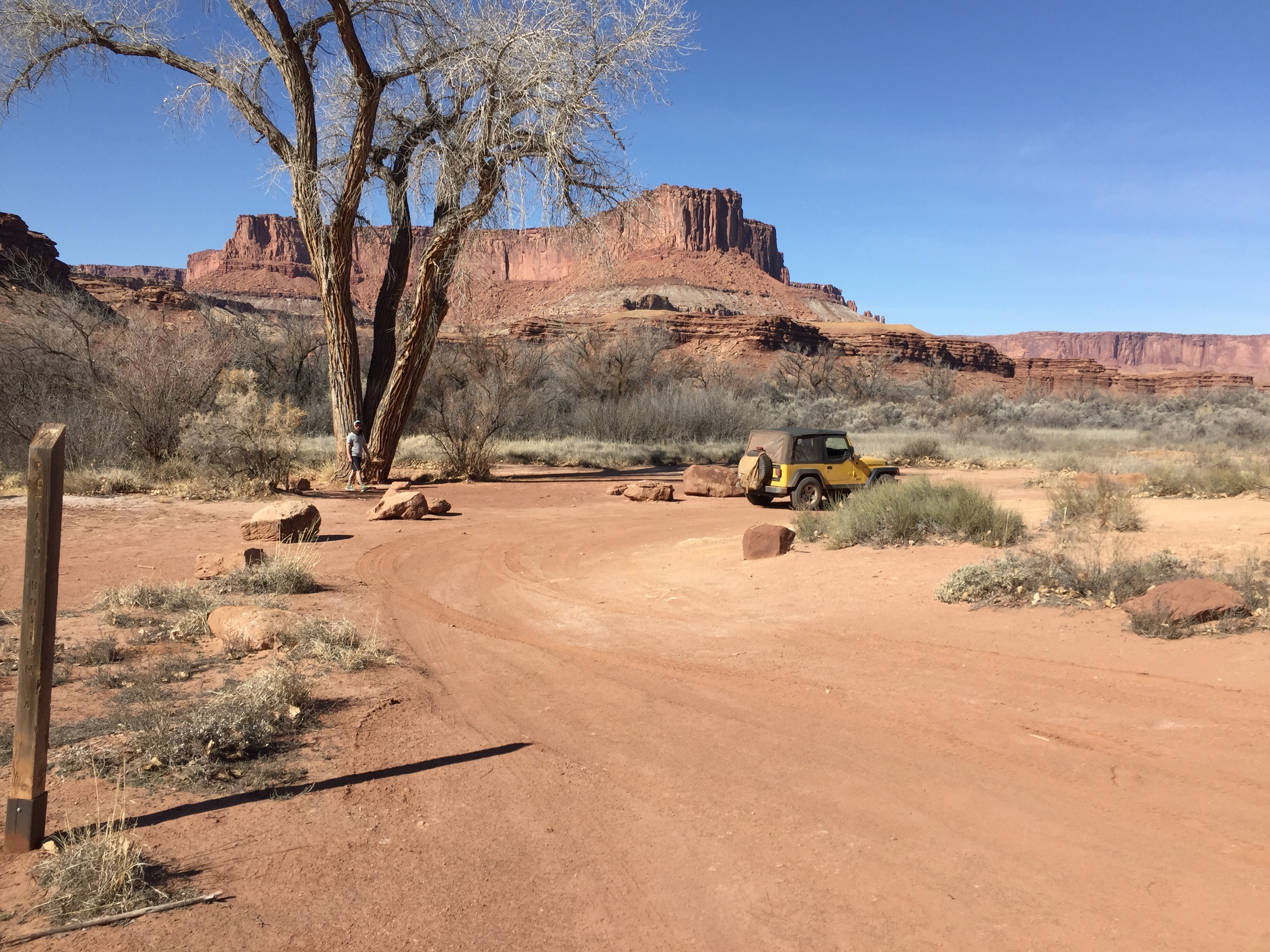
When we were up above we noticed a rig below and decided we would stop by and say hello. We ran across a great couple who’s tracks we had been following all week. They were in a decked out Jeep Rubicon build by AEV. After drooling over their rig for a few minutes we set back out on the trail looking forward to the canyon climb out of Potato bottom. This was by far one of my favorite parts of the trail, steep narrow switchbacks with amazing views over the valley.
Again I was so glad we did not meet someone coming down. The hike took a little longer than we thought so we decided setup camp before heading up Taylor Canyon just to make sure we were able to setup in the light.
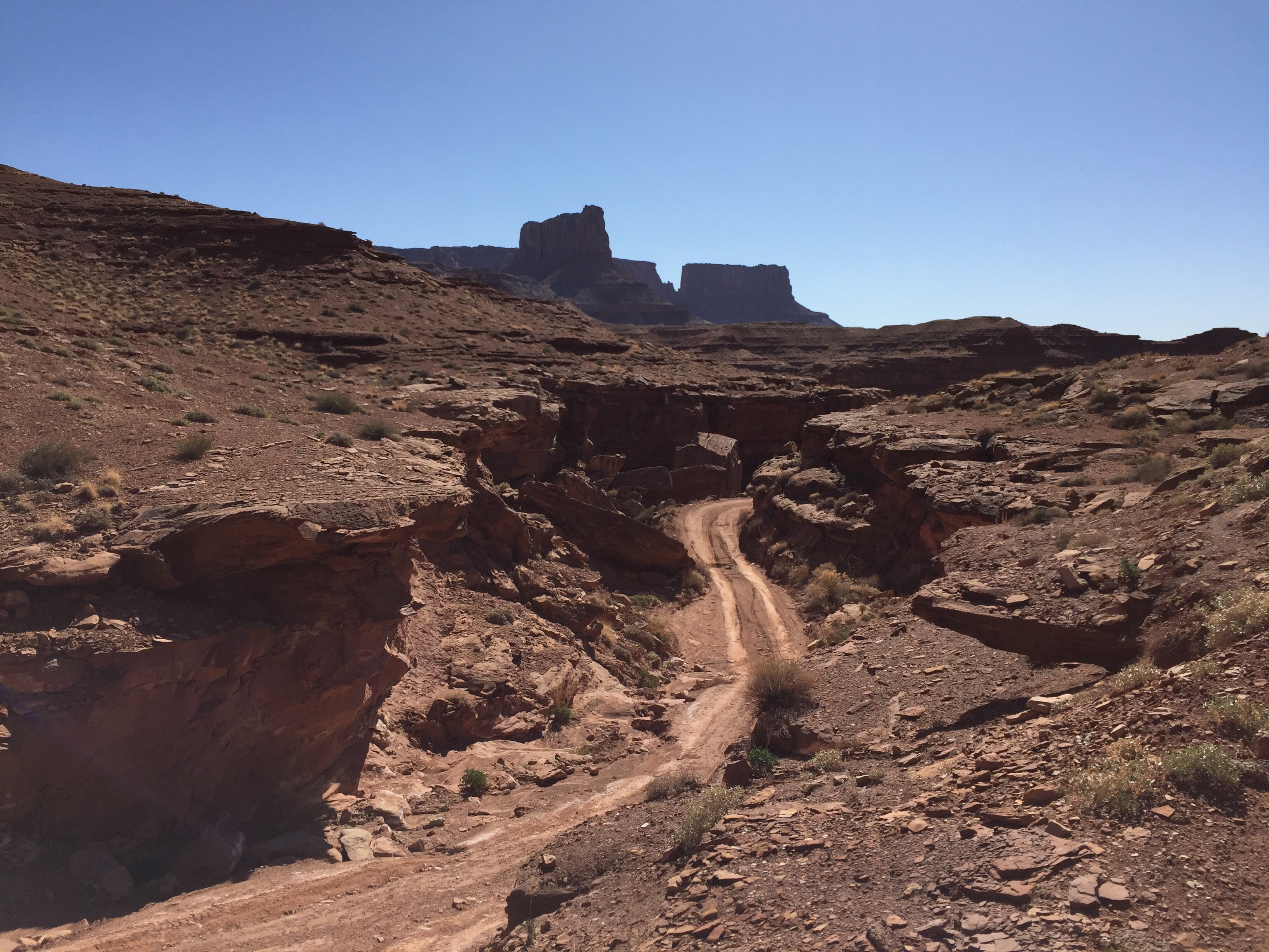
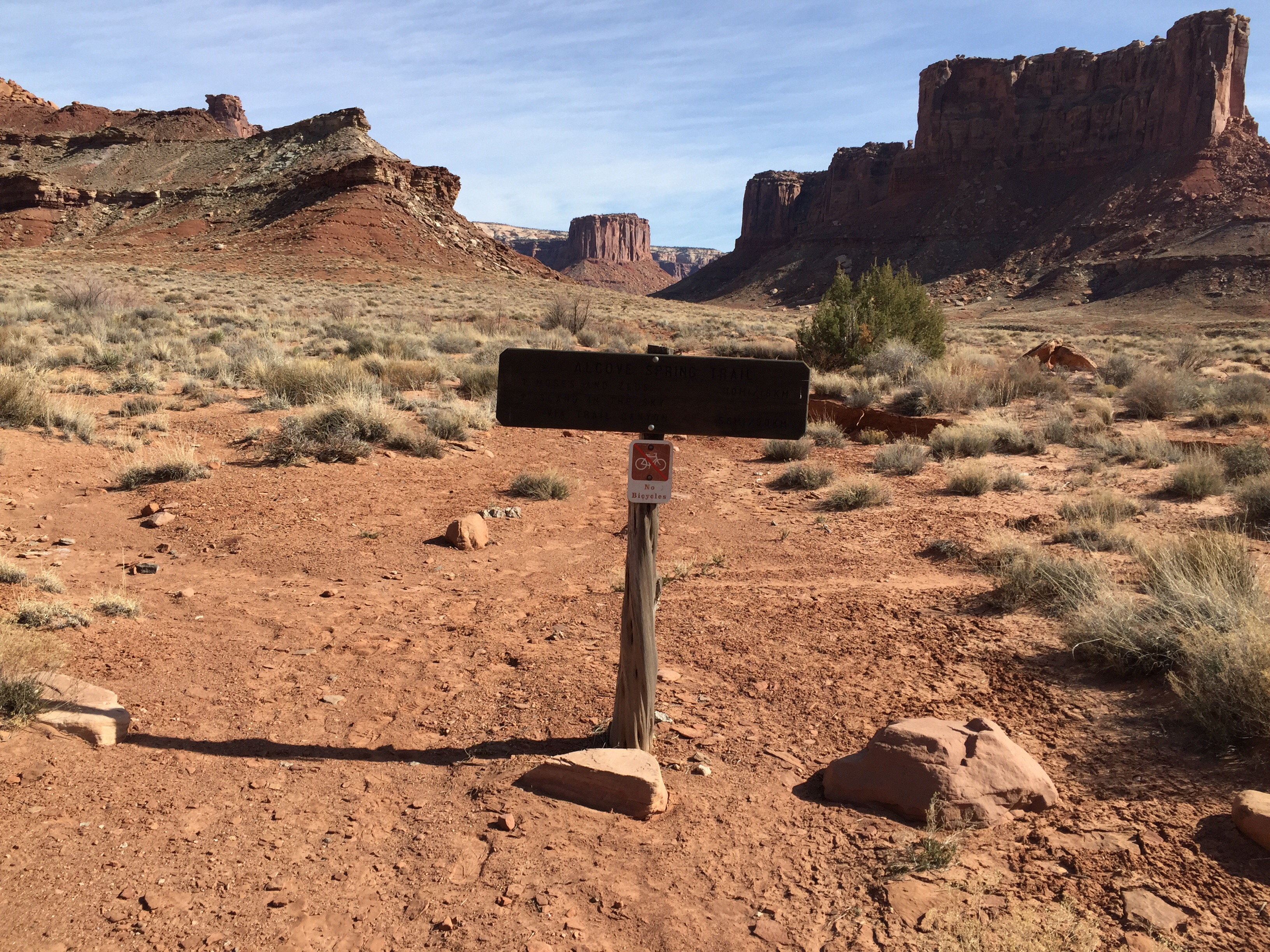
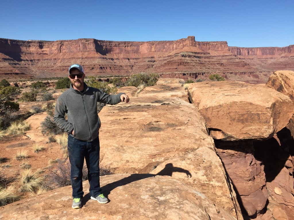
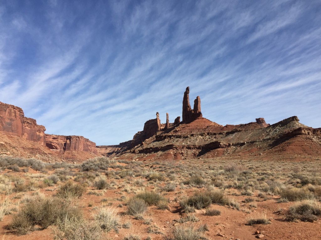
Taylor Canyon is a 6 mile trail leading to the Taylor Canyon Campground and the Moses and Zeus trail-head. The entire trail is incredible, similar to Lathrop you drive in and out of a wash, with a few tight spots surrounded by rock. I did not know there was a campground at the top, had I know would have certainly chosen it to stay at. The Canyon opens up into a nice valley, with an epic view and complete solitude. The 12 mile round trip is well worth it and if you have enough fuel I highly recommend you take the time to check it out.
 Back at camp we talked about the week and discussed our favorite parts. Mike and I both the only regret we had was not planning more time. We would have liked to have stayed a few more days giving us time to do some of the longer hikes leading to Island in the Sky. Most of those hikes were 6 miles each way and we just didn’t have enough time to spend a whole day hiking. We ran a slideshow of all of the photos and videos we had taken on our phones before retiring for the night.
Day Four Monday
Day 4 was meant to be a big travel day. We woke up early and drove the final 30 miles out of Canyonlands towards the 313 highway. The last 30 miles were just as cool as all of the other dirt miles we did. The Mineral road Switchbacks while not as steep as and grand as the Shafer Trail switchbacks are still incredible.
We knew we would be running tight on fuel, so we could only run the switchbacks once. Once on top we aired our tires back up and hit the scenic highway off of Island in the Sky back to Moab.
In Moab we had breakfast, and then started to head our way back to Monticello. Mike still had a 500 mile trip back to Roswell and I had a 200 mile drive back to Highland Utah.
Conclusion and Recommendations
No doubt the entire trip was life changing! We had so much fun, the vast open beauty is only something that can be truly appreciated through experience. Traveling the road in late February was incredible. Highs in the mid 60s and lows in the low 30s, with nearly no one on the trail, which was great. If doing the trip in two days and one night, we recommend staying at Whitecrack. The beauty of that area can not be overstated. I we were doing our trip over again I would replace Candlestick with Potato bottom, the proximity to the river is very cool and would be really nice during the really hot months, and then spend our last night at the top of Taylor Canyon. We knew we would have enough fuel to make the trip without extra fuel, but I wish we had brought more. While we did do several sections of trail multiple times I would have liked to have done more, but restrained myself because of fuel.
Last but not least competition during the busy season for permits and camp spots is very tough! You often have to book three months in advance so take the time to do the planning needed for a trip like this. Most of all have fun and drive safe, drive hard and drive often!
Have any questions about the trail or trip? Hit us up in the comments!
Day 1 Pictures:

Day 2 Pictures
Day 3 Pictures
Day 4 Pictures

 Previous Post
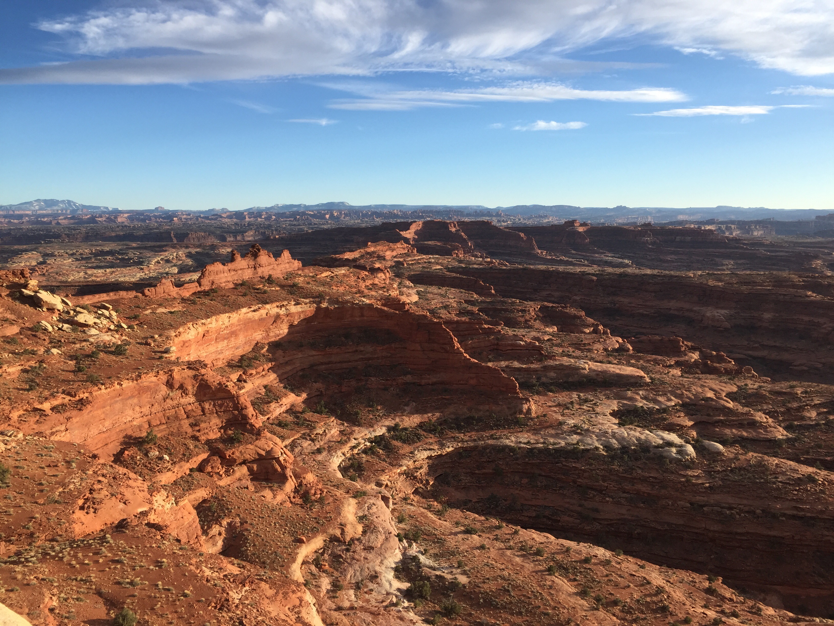
First of all great website! I left a question on your Youtube page but I’ll ask it similarly here. I’d like to make this trip in Oct/Nov with my family. We’ll have 7 kids, the last two will be about 2 years and about 6 months. We’ll have a new sprinter 4×4 van and I’m wondering what your thoughts about about a large, high clearance vehicle doing this trip. Particularly, the switchbacks, trail narrowness, and height clearance (wheel be just over 10 feet high). Additionally, what do you think about bumpiness for young children. It looks like an awe inspiring trip, I just want to make sure we’re doing our homework.
Hi, planning on doing the same trip with family. Kids 7 and 9… We have Toyota Tundra 2015 and small off road trailer – Turtleback Trailer – Do you recommend doing with Trailer… Tundra has 2inch lift and off road mud tires… Trailer has same tires as Tundra… 31 inch wheel…
Where do you get permits for camping?
Thanks much and great website and video
Sorry for the slow response! Somehow your comment got caught in our spam folder. You should be just fine with the Tundra and Turtleback Trailer. There are a few steep inclines Murphey Hodgeback in particular where there is not room for two vehicles to pass each other, which will leave one of the cars needing to backup which could be a bit tough, so you will have to rely on the other vehicle to do so.
Camping permits have to be booked several months in advance if you are trying to go in peak season (spring and fall) https://www.nps.gov/cany/planyourvisit/backcountrypermits.htm